The Nilgiris is not simply a hill station. It is the only place in India where the Western Ghats and Eastern Ghats converge — a geological meeting point that created a plateau unlike anywhere else on the subcontinent. At 2,552 square kilometres, rising from 300 metres at its lowest to 2,637 metres at Doddabetta, the district contains more ecological zones, more endemic species, and more microclimates than most entire states.
Understanding the geography is not academic. It is the reason the tea tastes the way it does, the reason the chocolate tempers differently here, the reason the essential oils from these slopes carry compounds that lower-altitude plants cannot produce, and the reason the British built their summer capital here and called the climate salubrious — health-giving — a word they reserved for very few places on earth.
Where is the Nilgiris? — Location and Borders
The Nilgiris district sits at the junction of three southern states — Tamil Nadu, Kerala, and Karnataka — which is why it has historically been a crossroads of language, culture, trade, and ecology.
Coordinates: Latitude 11°12'N to 11°37'N | Longitude 76°30'E to 76°55'E
District Headquarters: Ooty (Udhagamandalam)
Total Area: 2,552.50 km²
Borders:
-
North: Chamarajanagar district, Karnataka (separated by the Moyar River)
-
West: Wayanad and Malappuram districts, Kerala
-
South: Coimbatore district, Tamil Nadu
-
East: Erode district, Tamil Nadu
This tri-state location is ecologically significant. The Nilgiris receives moisture from both the Arabian Sea (via the Southwest Monsoon through Kerala) and the Bay of Bengal (via the Northeast Monsoon from the east) — giving it two distinct rainfall seasons and year-round green cover that single-monsoon hill stations cannot sustain.
Altitude — The Number That Explains Everything
Altitude is the single most important number in understanding the Nilgiris. Every characteristic that makes this district remarkable — the climate, the tea, the chocolate, the essential oils, the biodiversity — traces directly back to elevation.
| Town / Location |
Altitude |
Climate Character |
| Gudalur |
1,050m |
Tropical — warm, dense forest, paddy fields |
| Kotagiri |
1,800m |
Sub-tropical — tea gardens, moderate rainfall |
| Coonoor |
1,858m |
Temperate — misty, cool, colonial character |
| Ooty (Udhagamandalam) |
2,240m |
Highland temperate — cool year-round |
| Doddabetta Peak |
2,637m |
Alpine — frequently cold, frost in winter |
| Mukurthi Peak |
2,554m |
Alpine — border of Mukurthi National Park |
The lapse rate — the rate at which temperature drops with altitude — is approximately 6.5°C per 1,000 metres. This is why Ooty at 2,240m is consistently 8–10°C cooler than Coimbatore on the plains directly below it. And why Doddabetta at 2,637m is cold enough to produce frost while Ooty town is merely cool.
Two Distinct Geographical Zones
The Nilgiris district divides naturally into two zones with dramatically different characters:
Zone 1 — The Nilgiri Plateau (Upper Nilgiris)
The higher zone at approximately 1,800m and above, comprising Ooty, Coonoor, Kotagiri, and Wellington. This is the tea country — rolling shola-grassland mosaic landscapes where dense evergreen shola forest fills the valley floors and open montane grassland covers the ridges and plateaus. The British called these grasslands the "Downs" because they resembled the rolling downs of southern England.
The shola-grassland mosaic is one of the most ecologically important and threatened ecosystems in India. The shola forests act as water catchments — absorbing monsoon rainfall and releasing it slowly into streams throughout the year. The grasslands support species found nowhere else: Nilgiri tahr, Nilgiri marten, Nilgiri pipit.
Zone 2 — The Wayanad Tableland (Lower Nilgiris)
The lower zone at approximately 800–1,200m, comprising Gudalur, Pandalur, and the western slopes dropping towards Kerala. This is coffee, tea, cardamom and bamboo country — tropical rather than temperate, receiving far heavier Southwest Monsoon rainfall than the plateau above. The landscape is denser, more heavily forested, and distinctly Kerala-influenced in culture and ecology.
Rivers, Lakes and Water
The Nilgiris is the source of several significant river systems:
Pykara River — Rises at Mukurthi Peak, flows west through a series of cascades. The famous Pykara Falls (55m and 61m drops) are the final cascades before the river enters the Wynaad plateau. The Pykara Reservoir supplies water to Ooty town.
Bhavani River — Rises in the Nilgiris and flows east into the Cauvery system, one of South India's most important river systems.
Moyar River — Forms the northern boundary between the Nilgiris and Karnataka, flowing through Mudumalai Tiger Reserve.
Key Lakes:
-
Ooty Lake — Artificial reservoir (65 acres), built 1824 by John Sullivan for irrigation
-
Pykara Lake — Natural reservoir, considered sacred by the Toda tribe
-
Avalanche Lake — Natural lake in a shola valley at 2,250m — one of the most pristine in the Nilgiris
-
Emerald Lake — Reservoir in the Emerald valley, surrounded by tea estates
-
Mukurthi Lake — Within Mukurthi National Park, in the core ecological zone
Climate — The Science Behind "Salubrious"
The British used the word salubrious — meaning health-giving — specifically to describe Ooty's climate. It was not flattery. After decades of losing administrators and soldiers to heat and tropical disease on the plains, they found in Ooty a climate that was consistently cool, dry enough to prevent tropical infections, and yet never cold enough to freeze — a genuinely rare combination in South Asia.
Köppen Climate Classification: Cwb Subtropical highland climate — cool and temperate year-round, with a dry winter and moderate summer. The same classification as parts of the Scottish Highlands, the Ethiopian Highlands, and the Andes plateau. Globally rare. In India, almost unique.
Average Annual Rainfall: 1,920.80mm across the district (considerably higher in Gudalur/western slopes, lower in Kotagiri)
Rainfall Pattern: Dual monsoon — Southwest Monsoon (July–September) brings heavy rain to the western slopes and Gudalur. Northeast Monsoon (October–December) brings rain to the eastern slopes — Kotagiri and Coonoor. Ooty itself receives a moderate share of both.
Month-by-Month Climate Guide
| Month |
Max Temp |
Min Temp |
Rainfall |
Conditions |
Verdict |
| January |
20°C |
5°C |
Low |
Clear, dry, frost possible at dawn |
Excellent — crisp, clear skies |
| February |
22°C |
7°C |
Low |
Clear and bright |
Excellent — best visibility at Doddabetta |
| March |
24°C |
10°C |
Low–Moderate |
Warming, occasional afternoon clouds |
Very Good |
| April |
25°C |
12°C |
Moderate |
Peak season begins, Flower Show (May) |
Very Good — busiest season |
| May |
25°C |
13°C |
Moderate |
Flower Show mid-May, peak tourist traffic |
Good — crowded but vibrant |
| June |
21°C |
13°C |
High |
Monsoon arrives, mist and clouds daily |
Good for atmosphere, flexible itinerary |
| July |
19°C |
12°C |
Very High |
Full monsoon — western slopes very wet |
Best for waterfalls and green landscapes |
| August |
19°C |
12°C |
Very High |
Peak monsoon — Pykara Falls at maximum |
Lush, atmospheric, some road risk |
| September |
20°C |
12°C |
High |
Monsoon tapering — second bloom begins |
Very Good — post-rain freshness |
| October |
21°C |
10°C |
Moderate |
Second Season — gardens bloom again |
Excellent — underrated month |
| November |
19°C |
8°C |
Low–Moderate |
Cooling, clear afternoons |
Very Good |
| December |
19°C |
5°C |
Low |
Cold mornings, frost begins, festive |
Excellent — frost, clear skies |
The honest verdict by season:
October–February (Winter / Second Season) — The best time for clear views, photography, and comfortable walking. Doddabetta's telescopes are worth using in January and February when the plains below are clearly visible. Frost occurs on some mornings from December onwards — the racecourse grassland turns white, which surprises every first-time winter visitor.
March–May (Summer / Peak Season) — The most popular time. The Annual Flower Show in the second week of May is the single largest event in the Nilgiris calendar. Warm days, comfortable nights. Book accommodation at least 3–4 weeks ahead.
June–September (Monsoon) — The Nilgiris transforms. Tea estates turn intensely green. Pykara and the waterfalls are at their most dramatic. The Gudalur and western slopes receive extremely heavy rain — the annual average there exceeds 3,000mm. Ooty town is wetter than usual but rarely impassable. Some ghat roads may have landslide risk — check conditions before travelling.
Why Altitude Produces Better Tea, Chocolate and Essential Oils
The geography of the Nilgiris is inseparable from the quality of what grows here. Three mechanisms make altitude-grown products fundamentally different:
1. Slow growth concentrates compounds At 2,000+ metres, cool temperatures slow the metabolic rate of plants. Tea bushes, for example, take longer to produce the same leaf area as a lowland plant. Slower growth means more time to accumulate polyphenols, catechins, and aromatic oils in each leaf. The result is measurably higher antioxidant content and a more complex flavour profile.
2. UV intensity at altitude At 2,000–2,600 metres, the atmosphere filters less UV radiation. Plants respond by producing more protective compounds — particularly in the case of the Eucalyptus and Gaultheria plants that produce Nilgiris' famous essential oils, and the cocoa which flavours Ooty's altitude-tempered chocolate.
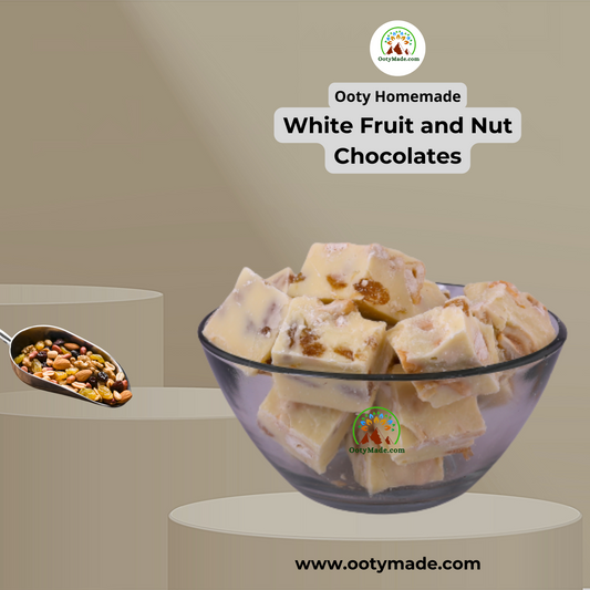
3. Temperature stability for tempering Ooty's consistently cool temperatures (16–20°C year-round) create ideal natural conditions for chocolate tempering — the process that gives well-made chocolate its snap, sheen, and clean melt. Industrial chocolate requires precision-controlled temperature machines to replicate what Ooty's climate provides as a baseline. This is why OotyMade chocolate is altitude-tempered — the mountain climate is part of the production process.
Shop Nilgiris Tea — Single Estate from the Blue Mountains → Shop Altitude-Tempered Ooty Chocolate → Shop Pure Nilgiris Essential Oils →
The Nilgiris Biosphere Reserve — UNESCO Recognition
The Nilgiris is the core of the Nilgiris Biosphere Reserve — India's first biosphere reserve, designated in 1986, and part of the UNESCO World Network of Biosphere Reserves. The biosphere spans 5,520 km² across Tamil Nadu, Kerala, and Karnataka, covering the Western Ghats mountain range which UNESCO declared a World Heritage Site in 2012.
Why this matters ecologically: The Western Ghats is one of the world's eight "biodiversity hotspots" — regions with exceptional concentrations of endemic species facing significant habitat loss. The Nilgiris district sits at the junction of three of the most biodiverse zones in this hotspot.
Endemic species of note:
-
Nilgiri Tahr (Nilgiritragus hylocrius) — mountain goat found only in the upper Nilgiris, classified as Endangered
-
Nilgiri Langur — distinctive black-coated monkey, endemic to the Nilgiris
-
Lion-Tailed Macaque — among India's most threatened primates, present in the lower shola forests
-
Nilgiri Pipit — bird species endemic to Nilgiris grasslands
-
Kurinji (Strobilanthes kunthiana) — the flowering shrub that blooms once every 12 years, turning the hillsides blue-purple and giving the Nilgiris its name ("Blue Mountains")
The Toda People — Original Inhabitants of the Nilgiris
The geography of the Nilgiris is inseparable from the Toda people who have lived here since before recorded history. The Todas are a pastoralist tribe who have traditionally inhabited the high plateau — their distinctive barrel-shaped thatched stone huts (mund) are still found across the upper Nilgiris.
Toda tradition holds that the Pykara river and several lakes are sacred — a belief that reflects thousands of years of relationship between these communities and the water systems that the Nilgiris geography produces.
The name "Ooty" itself traces to the Toda language: orrai-kal manru — meaning "single stone village" — a reference to a sacred stone in what is now Ooty town.
Frequently Asked Questions
What is the altitude of Ooty? Ooty (Udhagamandalam) is at 2,240 metres (7,349 feet) above sea level. This places it among the highest permanently inhabited towns in South India, and is the primary reason for its characteristically cool climate year-round.
What is the climate type of Ooty? Ooty has a Cwb climate under the Köppen classification — subtropical highland climate. This means warm, temperate conditions year-round with no extreme heat or extreme cold. Average temperatures range between 5°C and 25°C across all seasons. It is one of the very few places in India with this climate type.
What is the highest peak in the Nilgiris? Doddabetta at 2,637 metres is the highest peak in the Nilgiris and the second highest in South India (after Anamudi in Kerala at 2,695m). It is 9 km from Ooty town centre on the Ooty–Kotagiri road.
Why is the Nilgiris called the Blue Mountains? The name comes from the Kurinji flower (Strobilanthes kunthiana), which blooms once every 12 years and covers the hillsides in dense blue-purple. When in bloom, the slopes appear blue from the plains below. The Nilgiris last bloomed in 2018 and is expected to bloom again in 2030.
Why is Ooty cooler than other Tamil Nadu cities? Altitude. For every 1,000 metres of elevation, temperature drops by approximately 6.5°C. Ooty at 2,240m is over 2,000m higher than Chennai and Coimbatore. This lapse rate means Ooty is consistently 13–14°C cooler than the plains — not because of latitude or sea proximity, but purely because of altitude.
Does it snow in Ooty? True snowfall is extremely rare — perhaps once or twice a decade at the highest elevations. However, frost is common between December and February. On cold winter mornings, the racecourse, Wenlock Downs, and Doddabetta Peak can be covered in white frost that resembles a dusting of snow. Ground temperatures at Doddabetta have been recorded below -2°C on the coldest nights.
What is the best time to visit Ooty? October to February for clear skies, visibility, and comfortable temperatures. April–May for the Flower Show and peak season energy. July–September for dramatic monsoon landscapes and Pykara waterfalls at full flow. There is genuinely no bad month — each season offers a distinct experience. Full month-by-month guide → Ooty Weather and Best Time to Visit
Why does the Nilgiris receive rain from two monsoons? The district's position at the junction of the Western and Eastern Ghats means it is exposed to moisture from both the Arabian Sea (Southwest Monsoon, July–September) and the Bay of Bengal (Northeast Monsoon, October–December). The western slopes — Gudalur, Pandalur — receive the bulk of the Southwest Monsoon. The eastern slopes — Kotagiri, Coonoor — receive more of the Northeast Monsoon. Ooty, in the middle of the plateau, receives a share of both, which is why its annual rainfall (approximately 1,100mm) is significant but not as extreme as the 3,000mm+ recorded on the western slopes.
What is the Nilgiris Biosphere Reserve? India's first biosphere reserve, designated in 1986 and part of the UNESCO World Network of Biosphere Reserves. It spans 5,520 km² across Tamil Nadu, Kerala, and Karnataka. The core zone encompasses the Nilgiris, Mudumalai, Wayanad, Silent Valley, and Anamalai — one of the world's most biodiverse regions and part of the Western Ghats UNESCO World Heritage Site.
The Nilgiris in Numbers
| Fact |
Data |
| District area |
2,552.50 km² |
| Highest peak |
Doddabetta, 2,637m |
| Ooty altitude |
2,240m (7,349 feet) |
| Average annual rainfall |
1,920.80mm (district average) |
| Köppen climate type |
Cwb (Subtropical Highland) |
| UNESCO designation |
Nilgiris Biosphere Reserve (1986) |
| Western Ghats UNESCO status |
World Heritage Site (2012) |
| Endemic species |
3,300+ plant species, 100+ mammal species |
| Tea estates |
150+ in the district |
| Kurinji bloom cycle |
Every 12 years (next: ~2030) |
Why This Geography Makes OotyMade Products Different
Everything OotyMade sources comes from this geography. The altitude, the dual monsoon, the volcanic soil, the cool temperature range, the UNESCO-protected ecosystem — these are not marketing claims. They are measurable physical conditions that produce measurably different products.
The tea is brighter and more aromatic because altitude slows leaf growth and concentrates flavour compounds. The chocolate is altitude-tempered because Ooty's cool temperatures create the ideal crystallisation environment. The essential oils are more potent because UV intensity at 2,000m drives higher compound production in the plants.
When you buy from OotyMade, the geography is part of what you are receiving.
Explore Nilgiris Tea — Altitude-Grown, Estate-Traced → Explore Ooty Chocolate — Handmade at 2,000m → Explore Nilgiris Essential Oils — Steam-Distilled at Source → Explore GI-Tagged Ooty Varkey — The Nilgiris' Own Biscuit →