History of Ooty & The Nilgiris — From Ancient Tribes to the Queen of Hill Stations
By OotyMade — Nilgiris residents since 1970 · Updated April 2026
The Nilgiris is one of those rare places on earth where the evidence of human presence stretches back thousands of years, where indigenous communities that predate recorded history still live on the same land today, and where one of the most dramatic episodes of colonial transformation in South India happened within the span of a single lifetime.
This is the full story. Not a highlight reel — the actual sequence of events that made the Nilgiris what it is, told with specific names, specific dates, and specific buildings most travel guides overlook entirely.
At a Glance — The Nilgiris Timeline
| Era | Period | Key Event |
|---|---|---|
| Prehistoric | 5,000+ years ago | Indigenous tribes settle the Blue Mountains |
| Ancient | Before 1000 CE | Toda, Badaga, Kota, Kurumba communities established |
| Medieval | 14th–16th century | Vijayanagara Empire references; first written records |
| Portuguese Contact | 1602 | First recorded European sighting of the hills |
| British Discovery | 1819 | John Sullivan treks to Ooty; builds Stone House |
| Colonial Development | 1820–1900 | Summer capital, tea plantations, railway planned |
| Railway Era | 1891–1908 | Nilgiri Mountain Railway constructed and opened |
| Independence | 1947–1968 | Transition; Nilgiris District separated from Coimbatore (1868 formally, reorganised 1956) |
| Biosphere Era | 1986 | UNESCO designates Nilgiri Biosphere Reserve |
| UNESCO Railway | 2005 | Nilgiri Mountain Railway inscribed as World Heritage Site |
| Modern | 2010–present | Tourism expansion, GI tag for Ooty Varkey, digital economy |
Chapter 1 — Before the British: The Ancient People of the Blue Mountains
The hills that would eventually be named the Nilgiris had been inhabited for at least five thousand years before John Sullivan arrived in 1819. The communities that lived here had developed complex, interdependent social structures precisely suited to the plateau ecosystem — an ecosystem that was, and remains, unlike anywhere else in South India.
Who Lived Here
The Nilgiris supported five distinct indigenous communities, each occupying a specific ecological niche:
The Todas were — and remain — the most documented of the indigenous Nilgiris communities, primarily because their distinctive culture caught the immediate attention of British ethnographers. Pastoralists by tradition, the Todas herded water buffalo on the high plateau grasslands, an activity they considered not merely occupational but sacred. Their settlements, called Munds, consisted of characteristic barrel-vaulted structures built from bamboo and thatch — low-entrance buildings that retained warmth on cold plateau nights. Toda embroidery — Pukhoor — in red and black thread on white cloth is today a Geographical Indication-protected craft, meaning its authenticity is legally certified to the Nilgiris. Their language, Toda, belongs to the Dravidian family and has no writing system.
The Badagas were the agricultural community of the plateau, cultivating millet, ragi, beans, potatoes, and later tea on the upper slopes. They are the largest indigenous community in the Nilgiris today — approximately 250,000 people — and speak Badaga, a language distinct from but related to Kannada. The Badagas were the primary food producers for the multi-community system, and their relationship with the Todas was one of structured exchange: the Badagas supplied grain, the Todas supplied dairy products and ceremonial buffalo milk.
The Kotas were the craftspeople and musicians. In the traditional Nilgiris social system, Kotas made iron tools, pottery, and leather goods for all the other communities, and provided music at ceremonies across tribal groups. Kota music — particularly the nadaswaram ensemble used at funerals and festivals — is a significant component of Nilgiris intangible heritage.
The Kurumbas occupied the lower forest edges, living primarily from forest products — honey, roots, medicinal herbs. Their deep knowledge of the shola forest ecosystem and its medicinal plants is the foundation of what eventually became the Nilgiris essential oil industry. Kurumba honey collection and forest knowledge passed into the regional economy in ways that persist today.
The Irulas and several smaller communities occupied the lower slopes and forest margins, with strong knowledge of the terrain, wildlife, and snake handling traditions that are still practised by descendants today.
The Interdependence That Sustained the Plateau
What is historically significant about the Nilgiris indigenous communities is that they functioned as an integrated system. Each community filled a role the others could not — the Todas as pastoralists, Badagas as farmers, Kotas as craftspeople and musicians, Kurumbas as forest specialists. They traded with each other, attended each other's ceremonies, and maintained the plateau without destroying it.
This system had sustained the Nilgiris plateau for several thousand years when the first outsider arrived.
Chapter 2 — The Outside World Discovers the Hills (1602–1818)
The Portuguese Priest (1602)
The first recorded European to see the Nilgiris from outside was a Portuguese Jesuit priest named Father Fenicio, who wrote about the "mountains covered in blue haze" visible from the Coimbatore plains in 1602. He did not climb them. The hills were considered inaccessible — the ghat terrain was dense jungle, the paths were controlled by the Kurumbas who had no interest in guiding outsiders, and malaria was endemic in the foothills.
For the next two centuries, the hills remained outside the knowledge of European administrators even as the British East India Company gradually consolidated control over the Coimbatore and Madurai territories below.
Why They Stayed Unknown
The Nilgiris' isolation was not accidental. The ghat routes — the steep paths connecting the plains to the plateau — were genuinely treacherous: dense forest, narrow tracks that became impassable in monsoon, and wildlife including tiger, leopard, and elephant that made unguided travel dangerous. The indigenous communities had every reason to maintain this isolation and did so effectively for centuries.
The Coimbatore Gazette of 1810 mentions the hills as "inhabited by jungle tribes, of no commercial interest to the Presidency" — a colonial dismissal that was about to be proved entirely wrong.
Chapter 3 — John Sullivan and the British Transformation (1819–1850)
The Collector Who Changed Everything
In 1819, John Sullivan — the Collector of Coimbatore, a 36-year-old British civil servant — decided to investigate the hills his predecessors had ignored. He hired Toda guides, negotiated access through the Kurumba-controlled ghat paths, and made the climb.
What he found at the top changed the trajectory of the entire district.
The plateau at 2,240 metres was cool in summer — genuinely cool, with temperatures that felt nothing like the 40°C heat of the Coimbatore plains he had left below. The air was clear. The grasslands were open and green. The mist moved across the plateau in the morning and cleared by midday. It was, as Sullivan recorded in his dispatches to Madras, "entirely unlike anything I had encountered in the Indian subcontinent."
The Stone House — The First Building (1822)
Sullivan returned and began construction of his personal residence in 1822. The Stone House — built from the granite of the Nilgiris plateau, two storeys, solid and heavy in the colonial administrative style — was completed that year and became the first non-tribal permanent structure in Ooty.
The building stands today inside the Government Arts College campus in Ooty. It functions as a museum. Entry fee: ₹30 for adults. It holds Toda and Badaga artefacts, colonial-era photographs, and taxidermied Nilgiris wildlife. The building itself — the weight of the stone, the thickness of the walls, the height of the ceilings designed for a climate that needed insulation not ventilation — tells the history more effectively than any exhibit inside it.
Sullivan's local name for the house was 'Kal Bangla' — the stone bungalow.
What Sullivan Brought With Him
Sullivan did not merely build a house. He introduced tea cultivation to the Nilgiris plateau — bringing Camellia sinensis plants from China and establishing the first experimental plots on the upper slopes in the 1830s, an experiment that would eventually produce the Nilgiris tea industry that continues today. He introduced potato cultivation, which the Badaga community adopted with great success and which continues to be grown on the plateau. He introduced European vegetables — carrots, cabbages, cauliflower — that are still called "English vegetables" in local markets.
He also built the first road connecting the plains to the plateau in 1823 — the Kallar–Coonoor–Ooty route that remains the primary ghat road today — and laid the foundation for the Ooty Lake in 1824, an artificial reservoir that is now the centre of Ooty's tourist economy.
The Summer Capital (1830s–1900)
Sullivan's dispatches to the Madras Presidency were persuasive. By the 1830s, British administrators were making the climb to spend their hot-season months on the plateau, and the development of Ooty accelerated rapidly. The pace of change on the plateau between 1820 and 1880 was extraordinary:
1830s: The Government House — the summer residence of the Governor of Madras — was established in Ooty, formally declaring it the Summer Capital of the Madras Presidency. Governors and their entire administrative staff relocated here from April to June each year.
1848: The Government Botanical Garden was established under the direction of the Marquess of Tweeddale. The 55-acre garden, laid out on the slopes above Ooty town, was designed by W. G. McIvor of the Royal Botanic Gardens at Kew. The 20-million-year-old fossilised tree trunk visible in the garden today was already ancient when the garden was planted around it.
1850s–1870s: St. Stephen's Church was established (the original structure dates to 1830; the current building was completed in 1867) — the oldest church in the Nilgiris. The Nilgiri Hunt — a fox hunt in the British tradition — was founded. Boarding schools including Lawrence School (Lovedale, 1858) and Breeks Memorial School were established, drawing families from across British India who wanted their children educated in a cool climate. The Ooty Club was established — and famously, snooker is said to have been invented at the Ooty Club in 1875 by Sir Neville Chamberlain, a British Army officer. The claim is disputed, but the Ooty Club still displays the original snooker table.
1861: The official census recorded 9,000 residents in Ooty town. By 1900, the population had grown to over 30,000, representing one of the most rapid urban transformations in colonial South India.
Chapter 4 — The Railway That Defined an Era (1891–1908)
Why a Railway Was Necessary
By the 1880s, the road from the plains to Ooty — though improved from Sullivan's original track — was still a journey of several days by bullock cart. The volume of people and goods moving between the Coimbatore plains and the Nilgiris plateau was straining the road infrastructure. The British administration in Madras decided a railway was required.
The engineering problem was formidable. The Nilgiri Mountain Railway had to climb from 326 metres at Mettupalayam to 2,203 metres at Ooty — an elevation gain of 1,877 metres in 46 kilometres. The average gradient on the lower section between Mettupalayam and Coonoor (the steepest section) is 1 in 12.28 — among the steepest rack railway gradients in the world.
The Rack and Pinion Solution
The Swiss engineer Wilhelm von Abt designed the rack-and-pinion system adopted for the Nilgiri Mountain Railway. A toothed rack rail is laid between the running rails, and a pinion gear on the locomotive engages this rack to provide traction on grades that conventional wheel-on-rail adhesion cannot manage. Between Mettupalayam and Coonoor, the rack section handles gradients that would cause a conventional train to slip backward.
Construction began in 1891. The lower section between Mettupalayam and Coonoor opened in 1899. The upper section from Coonoor to Ooty opened on 15 June 1908 — using a different, milder gradient that did not require rack traction.
The railway line passed through 16 tunnels, across 250 bridges and culverts, and through terrain that required the construction teams to cut through solid Nilgiris granite for months. The tunnels were bored by hand and with black powder, a process that advanced at roughly 3–4 feet per day in the harder rock sections.
UNESCO World Heritage Status (2005)
In 2005, the Nilgiri Mountain Railway was inscribed as an extension of the Mountain Railways of India UNESCO World Heritage Site (originally inscribed in 1999 for the Darjeeling Himalayan Railway). The inscription recognised the railway's outstanding universal value as an example of innovative engineering responding to the challenges of mountain terrain.
The railway continues to operate today. Four services run daily between Mettupalayam and Ooty, with the return journey from Ooty covering 46 km in approximately 5 hours. The blue-liveried steam locomotives — still coal-fired on the lower Mettupalayam–Coonoor section — are the same design used when the railway opened.
Current schedule reference: Check IRCTC for current timings. The 09:10 AM departure from Ooty is the most popular for the scenery. Book well in advance for April–June. Full toy train guide here.
Chapter 5 — The Colonial Heritage Built Into the Town
The buildings the British left in Ooty are not merely architectural remnants. They are the physical record of how the town was imagined, built, and used by a colonial administration. Several are still standing.
The Stone House (1822)
John Sullivan's original residence. The first permanent non-tribal building in the Nilgiris. Now the Government Arts College museum. Open to visitors: ₹30 entry, 9 AM–5 PM. Location: Government Arts College campus, Ooty town.
St. Stephen's Church (1830/1867)
The oldest church in the Nilgiris. The original structure was built in 1830; the current building was completed in 1867. The timber used in the construction was taken from Tipu Sultan's palace at Srirangapatna — reportedly brought to Ooty in the early years of the settlement. The church is still an active congregation and is open to visitors. Location: Charring Cross area, Ooty town.
Fernhill Palace (1844)
Built in 1844 as the summer residence of the Maharaja of Mysore, Fernhill Palace is one of the most architecturally significant buildings in the Nilgiris — a 50-acre estate with a main building in the Scottish Baronial style, combining the aesthetics of both British colonial architecture and Indian royal taste. Fernhill demonstrates that the British influence on Ooty extended to attracting Indian royalty to the plateau as a summer destination. The building is now a luxury hotel.
The Nilgiris Club (1859) and The Ooty Club (1888)
The clubs of colonial Ooty were the social institutions of British hill station life. The Ooty Club — still operating as a members' club — claims the invention of snooker in 1875. The current building dates to the late 19th century. The billiards room where snooker is said to have been invented is still in use.
Lawrence School, Lovedale (1858)
One of the oldest boarding schools in India, established in 1858 for the children of British soldiers. The school campus at Lovedale, 7 km from Ooty, is built around a granite chapel and stone buildings that sit on the hillside above the Nilgiri Mountain Railway line. The UNESCO railway passes directly below the school grounds — a genuinely striking visual where the historic train runs below the historic school buildings.
Chapter 6 — Independence and the Modern Nilgiris (1947–Present)
1947: The British Leave, The Hills Remain
Indian independence in 1947 brought administrative change to the Nilgiris without immediately changing its character. The hill station continued as a destination for Indian government officials who simply replaced the British in the same bungalows. Many of the colonial institutions — the boarding schools, the clubs, the tea estates — continued operating under new ownership.
The Nilgiris District, which had been part of Coimbatore District administratively, was formally established as a separate district in 1868 under British administration and was reorganised as an independent revenue district in 1956 following the States Reorganisation Act.
1986: The Nilgiri Biosphere Reserve
The ecological significance of the Nilgiris was formally recognised in 1986 when UNESCO designated the Nilgiri Biosphere Reserve — India's first biosphere reserve — covering 5,520 sq km across the three states of Tamil Nadu, Kerala, and Karnataka. The reserve encompasses the Nilgiris district, the Mudumalai Tiger Reserve, Silent Valley National Park (Kerala), and Nagarhole and Bandipur National Parks (Karnataka), forming the largest protected elephant and tiger habitat in South Asia.
The biosphere reserve designation reflects what the indigenous communities had known for millennia — that the Nilgiris plateau and its surrounding forests function as a single ecological unit. The Toda grazing lands on the plateau, the shola forests on the slopes, the rivers flowing to both the eastern and western plains — they are one system.
Tea: From Colonial Experiment to District Identity
John Sullivan's experimental tea plots of the 1830s became, over the following century, one of the most productive tea districts in the world. The Nilgiris tea industry today:
Covers approximately 65,000 hectares across the district. Produces 25–30% of India's total tea output by volume. Employs approximately 400,000 people in cultivation and processing. Exports primarily to Russia, Iran, and CIS countries as well as the United Kingdom. Produces orthodox (whole-leaf), CTC (crush-tear-curl), and specialty green and white teas at estates ranging from 1,400 to 2,500 metres elevation.
The taste characteristic unique to Nilgiris tea — the bright, brisk, frost-affected flavour of January–February flush, and the muscatel notes of high-altitude orthodox — is a direct product of the elevation, the specific soil chemistry, and the cool nights that slow the oxidation process in the leaf. Shop single-estate Nilgiris tea from OotyMade.
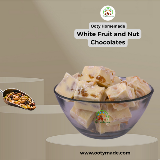
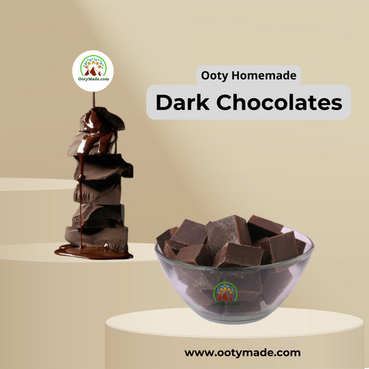
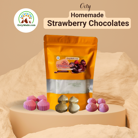
Chocolate: From Cacao Import to Local Craft Tradition
Cacao was introduced to the Nilgiris by the British in the late 19th century. By the 1930s, local chocolatiers had developed a distinct Ooty chocolate tradition — using fresh Nilgiris dairy milk, altitude-tempered technique, and locally sourced flavourings including Nilgiris cardamom, wild honey, and nuts. The Ooty Summer Chocolate Festival today brings international chocolatiers to the hills to see the technique and taste the product.
More than 22% of the Ooty population is estimated to be engaged in the chocolate industry in some form. Shop handmade Ooty chocolates from OotyMade.
The GI Tag Era: Protecting What Is Genuine
In recent years, the Nilgiris has used the Geographical Indication (GI) system to formally protect its most distinctive products:
Ooty Varkey — the traditional Badaga-origin hard biscuit made with mava, wheat, and sugar — received GI Tag No. 529, making it legally protected as a product authentic only when made in Ooty and surrounding Nilgiris regions by traditional methods. OotyMade sources GI-certified Varkey directly from licensed producers. Shop GI-tagged Ooty Varkey.
Toda Embroidery — the red-and-black embroidery tradition of the Toda community — also holds a GI tag, protecting the craft from imitation.
Chapter 7 — Why the Nilgiris Matters Today
The Nilgiris is not a preserved relic of the past. It is a working landscape — tea estates that export to Europe, boarding schools that educate students from across India, indigenous communities maintaining traditions under genuine pressure, forests that are part of the largest protected wildlife corridor in South Asia, and a product tradition (tea, chocolate, essential oils, Varkey) that has been continuous for over 150 years.
Understanding the history of the Nilgiris is understanding why its products are what they are. The tea tastes the way it does because of the altitude Sullivan's 1820s road made accessible. The chocolate tradition exists because of the cacao the British brought. The essential oils are distilled from plants — eucalyptus, gaultheria, lemongrass, camphor — that have been grown in the Nilgiris for generations by communities whose knowledge of the terrain predates colonial contact by thousands of years.
When you buy a product from OotyMade, you are buying something made in this place, by people from this place, at this altitude, with this history. That is not marketing language. It is simply accurate.
Frequently Asked Questions
What does "Nilgiris" mean and where does the name come from? Nilgiris comes from two Sanskrit words: Nil (blue) and Giri (mountain). The Blue Mountains have been called this for centuries. There are two explanations for the blue colour: the first is the persistent blue-grey haze that sits over the hills due to the density of shola vegetation releasing terpene compounds into the air. The second, more poetic explanation, is the Neelakurinji flower — Strobilanthes kunthiana — which blooms once every twelve years and covers the hillsides in a wave of blue-purple. The last mass bloom was in 2018. The next is expected in 2030.
When was Ooty founded and by whom? Ooty as a developed settlement was effectively founded by John Sullivan, the Collector of Coimbatore, who first climbed to the plateau in 1819 and built the Stone House in 1822. However, the plateau had been inhabited by the Toda, Badaga, Kota, Kurumba, and Irula communities for at least five thousand years before Sullivan arrived. The more accurate framing is that Sullivan founded colonial Ooty — the British settlement — not the Nilgiris itself, which predates recorded history.
What is the Stone House and can I visit it? The Stone House is John Sullivan's original residence, built in 1822 from Nilgiris granite. It is the first permanent non-tribal building in Ooty. It stands today inside the Government Arts College campus in Ooty and operates as a museum with Toda and Badaga artefacts, colonial-era photographs, and natural history exhibits. Entry is ₹30 for adults. It is open 9 AM–5 PM. It is genuinely worth visiting — most tourists skip it, which is a mistake.
When was the Nilgiri Mountain Railway built and why is it a UNESCO site? Construction of the Nilgiri Mountain Railway began in 1891. The lower section (Mettupalayam to Coonoor) opened in 1899; the upper section (Coonoor to Ooty) opened on 15 June 1908. It was inscribed as a UNESCO World Heritage Site in 2005 as an extension of the Mountain Railways of India. The UNESCO inscription recognises the railway as an outstanding example of innovative engineering — specifically the rack-and-pinion system that enables the train to climb gradients as steep as 1 in 12.28. The train still operates daily using the original design steam locomotives on the lower section.
What is the Nilgiri Biosphere Reserve? The Nilgiri Biosphere Reserve was established in 1986 as India's first UNESCO Biosphere Reserve. It covers 5,520 square kilometres across Tamil Nadu, Kerala, and Karnataka and encompasses Mudumalai Tiger Reserve, Silent Valley National Park, Nagarhole and Bandipur National Parks, and the Nilgiris plateau. It is the largest intact block of tropical forest in South Asia and home to the largest elephant population in Asia. The reserve is the reason why protected forests around Ooty — Avalanche, Mukurthi, Upper Bhavani, Parsons Valley — require Forest Department permits for visitor access.
Who invented snooker and was it really in Ooty? The most widely cited version of snooker's origin places it at the Ooty Club in 1875. The story credits Sir Neville Chamberlain, a British Army officer stationed at Jabalpur, who was visiting Ooty and is said to have combined two existing billiards games to create the rules of snooker. The Ooty Club displays what it describes as the original snooker table. The claim has been contested — other accounts place the invention elsewhere — but the Ooty Club's account has the most documentation and the oldest physical evidence. Whether or not snooker was invented in the Ooty Club, the claim is plausible and the context is genuine: officers on hill station leave in the 1870s had time, facilities, and the particular creativity that results from being in a comfortable place with nothing urgent to do.
What is the Kurinji flower and when does it bloom next? Neelakurinji (Strobilanthes kunthiana) is an endemic shrub of the Nilgiris and Western Ghats that blooms once every twelve years. When it blooms, entire hillsides turn a distinctive blue-purple colour — the most dramatic natural event in the Nilgiris. The last mass bloom was in 2018, concentrated around Mukurthi National Park. The next bloom is expected in 2030. The flower's bloom cycle is the leading theory for why the hills have been called "blue mountains" — though the competing explanation (the persistent atmospheric haze from shola vegetation) is equally plausible.
Further Reading on OotyMade
The history of the Nilgiris is inseparable from its landscape, its products, and the experience of being here. Explore more:
Ooty Travel Guide 2026 — Complete Planning Resource Ooty to Coonoor Toy Train — Full Guide, Timings & Booking Nilgiris Tea — Complete Guide to Estates, Varieties & How to Buy Hidden Places in Ooty — 12 Offbeat Spots Only Locals Know Ooty Weather Guide — Best Time to Visit by Month GI-Tagged Products of India — What the Certification Means
OotyMade.com — Operating from the Nilgiris since 2012. DPIIT Startup India recognised. 3 lakh+ orders shipped across India. We live here. Everything on this page can be verified by walking out the front door.
Featured collection
-
Ooty White Chocolate with Fruits & Nuts — Handmade Nilgiris | OotyMade
Regular price From Rs. 345.00Regular priceUnit price / per -
Ooty Vegan Dark Chocolate — High Cocoa, Sugarless & Handmade in the Nilgiris | OotyMade
Regular price From Rs. 285.00Regular priceUnit price / per -
Ooty Orange Chocolate — Handmade Citrus Flavoured Bar | OotyMade
Regular price From Rs. 375.00Regular priceUnit price / per -
Ooty Strawberry Chocolate — Handmade Creamy Flavoured Bar | OotyMade
Regular price From Rs. 375.00Regular priceUnit price / per